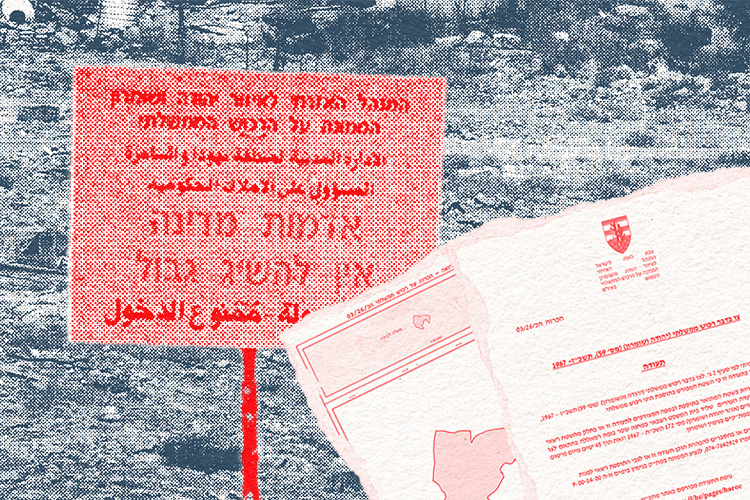
To expand the settlement enterprise, Israel must continually increase the territory and land reserves under its control. Successive Israeli governments have used a range of mechanisms to transfer land from Palestinian control and use to Israeli control, making it available for settlements, the retroactive approval of outposts and infrastructure serving Israeli civilians. Until 1979, Israel used military orders to seize privately owned Palestinian land and build settlements on it. That year, however, in the Elon Moreh case, the High Court of Justice ruled that the Israeli authorities could seize private land only to meet a clear and urgent military need, not to establish settlements. Following the judgment, Israel stopped using military seizure orders to establish settlements and found other ways to allocate land to them.
State Land Declarations
A key tool Israel uses to transfer land to its control is declaring it state land. Formally, any land in the West Bank that is not privately owned is considered public land, or state land, whether or not it is registered as such. Under Israel’s interpretation of Ottoman land law, land may be declared state land if private ownership has not been proven or if it has not been continuously cultivated. International law requires the military to administer state land for the benefit of the local population living under occupation, for example to establish communities or provide necessary infrastructure.
Under Israel’s occupation regime, however, state land declarations have become a central means of transferring land to settlements, expanding Israeli control and laying the groundwork for the West Bank’s annexation. Israel has allocated the overwhelming majority of land declared state land in furtherance of settlement expansion. Declarations also serve to retroactively approve illegal Israeli construction. By comparison, of all the state land in the West Bank that the Civil Administration allocated for any purpose between 1967 and 2024, only 0.24% was allocated for Palestinian use.
According to Peace Now monitoring, approximately 27,119 dunams have been declared state land under Israel’s 37th government, an unprecedented use of this mechanism for settlement purposes. In 2024 alone, 24,258 dunams were declared state land, compared with 22,284 dunams between 2000 and 2023. These declarations partly served to retroactively approve the Evyatar outpost, as well as allocate land to build new settlements and expand existing ones. They included more than 20,000 dunams in the Jordan Valley, an area Israel has for years targeted for annexation and permanent control. In 2025, 1,200 dunams were declared state land, in part to retroactively approve the outpost of Malachei Ha’shalom and expand the outposts of Havat Gilad and Yetedot. By June 2026, another 1,160 dunams had been declared state land, in part for the retroactive approval and expansion of the outpost of Giv’at Ha’roeh.
Nature Reserves, Historical Sites and Tourism
By designating land as nature reserves, parks, forests and historical sites, Israel can restrict farming, grazing and construction by West Bank Palestinians on their land and take control over it. Over the years, Israel has designated hundreds of thousands of dunams in the West Bank as nature reserves, dispossessing Palestinians of this land. In Area C, the Civil Administration manages reserves and areas designated as national parks through the Staff Officer for Nature Reserves and National Parks. Archaeological and historical sites are managed through the Staff Officer for Archaeology.
In practice, the Civil Administration has handed the management of some reserves and historical sites to the Israel Nature and Parks Authority and settlement local authorities. Placing natural and historical sites in the West Bank under Israeli civilian authorities blurs the distinction between the West Bank and Israel. The transfer is itself a form of annexation, extending the operation of state institutions beyond Israel’s sovereign borders.
In recent years, Israel has designated tens of thousands of dunams in the West Bank as nature reserves and invested enormous sums in developing natural, historical and tourist sites. The largest designation to date expanded the Um Zuqa reserve (Nahal Og) near Jericho by approximately 22,000 dunams, including privately owned Palestinian land. As a result, landowners must obtain the Civil Administration’s permission to cultivate their land or graze livestock on it. The expanded reserve also encompasses the outpost Uri’s Farm. The designation thus serves both to deny Palestinians access to the area and to consolidate an Israeli outpost.
The appropriation of historical sites has also accelerated. During its term, Israel’s 37th government allocated hundreds of millions of shekels to develop “Jewish heritage sites.” These include the archaeological site of Sabastiya, near the Palestinian village of the same name, part of which lies on privately owned Palestinian land. In November 2025, the Civil Administration announced the expropriation of the archaeological site at Sabastiya, the largest expropriation of an archaeological site in the West Bank since 1967. The site’s expropriation and development as a tourist attraction for the Israeli public restrict local Palestinians’ access to their heritage and push them off their land.
Archaeological and historical sites are used not only to take over land, but also to appropriate history and foster a sense of belonging to the territory. By controlling these sites and how they are presented, Israel can emphasize the Jewish connection to them while marginalizing the heritage of other peoples and cultures, particularly Palestinian heritage. Presenting the sites as part of Israel’s heritage obscures the West Bank’s status as occupied territory and gives annexation a historical and ideological justification.
Expanding Jurisdictions and Special Security Areas
The municipal boundaries of regional councils and settlements in the West Bank are set by orders issued by the military commander. Their jurisdictions extend far beyond their built-up areas and the land they actually use. Approximately 66% of Area C falls within the boundaries of Israeli regional councils. According to Bimkom, individual settlements’ jurisdictions cover 16.5% of Area C. They include a substantial share of the land Israel has designated as state land, even where the settlement has no municipal need for it. Once land is included in a settlement’s jurisdiction, Palestinians are prohibited from entering it, making it possible to block their access to land, grazing areas and roads.
Since the beginning of 2023, the Military Commander has issued 114 new orders setting settlement jurisdictions and expanding existing ones, equivalent to the number of orders issued in the preceding 22 years combined. These orders added more than 25,000 dunams to settlement jurisdictions. For example, the jurisdiction of the settlement of Geva Binyamin was expanded by approximately 1,100 dunams to include the unauthorized outpost of Bnei Adam and enable its retroactive approval. The expansion left two enclaves of privately owned Palestinian land within the jurisdiction, one covering 111 dunams and the other 11 dunams. The Jordan Valley Regional Council’s boundaries were also expanded by approximately 206 dunams in the heart of the Palestinian village of al-Jiftlik. The outpost of Ahiya was incorporated into Shilo’s jurisdiction as part of its retroactive approval, and a jurisdiction was defined for the settlement of Nahal Heletz near Bethlehem. Jurisdictions were also defined for the outposts of Kanfei Hashahar and Metzokei Eretz on land from which the Palestinian communities of ‘Ein Samia and Mu’arrajat Central had been expelled. With this, Israel entrenches these communities’ expulsion and prevents their return to their land. In this way, Defining jurisdictions for new settlements serves as a tool for implementing Israel’s annexation policy through land takeovers and the ethnic cleansing of Area C.
Meanwhile, since October 7, 2023, Israel has also expanded the so-called Special Security Areas (SSAs) around settlements. These are designated security buffer zones that ostensibly cannot be entered without approval. In practice, the restrictions apply primarily to Palestinians, who must obtain permits and coordinate access to agricultural and grazing land in advance. SSAs, therefore, extend settlement control over more land without changing ownership or expanding municipal boundaries. In November 2023, at the height of the olive harvest, Smotrich demanded that the political leadership instruct the military to create “sterile security zones around settlements and roads” and bar Palestinians from entering them.
Road Closures
Road closures are part of a broader system of dispossession, land takeovers and expansion of Israeli control across the West Bank. Since October 2023, the military has placed gates, checkpoints, dirt mounds and piles of rocks on roads connecting Palestinian communities to main roads and their farmland to restrict Palestinian movement. In some cases, settlers installed the obstructions, and the military did not remove them. In more serious cases, the military subsequently adopted them, formalizing them through orders issued by the Military Commander. According to data from the United Nations Office for the Coordination of Humanitarian Affairs, as of December 2025, there were 925 permanent or temporary movement obstacles in the West Bank and East Jerusalem.
As of December 2025, at least 20% of the obstacles installed in the West Bank blocked access to agricultural land. Farmers from 98 communities were required to obtain prior coordination with the military to reach land near settlements, sometimes only twice a year. And so, Israel uses movement obstacles, some installed by settlers, to cut farmers off from their land and livelihoods, while allowing settlers to expand their control over the same area. Checkpoints, fences and roadblocks, together with settler violence, severely undermine Palestinian farmers’ ability to cultivate their land continuously. Given Israel’s interpretation of Ottoman land law, preventing access and cultivation makes it easier for the state to seize the land, portray it as uncultivated and declare it state land.
Declaring state land and nature reserves, expropriating historical sites, expanding jurisdictions, creating buffer zones and blocking access to land all serve the same purpose: reducing the space available to Palestinians and bringing it under Israeli control. These mechanisms change the distribution of land in the West Bank, entrench Israeli control and advance the annexation of the occupied territory.

 Disable/Enable big cursor white
 Disable/Enable big cursor black